
High temperatures in the UK will continue this week but rain and thunder can be expected as the summer holidays get going.
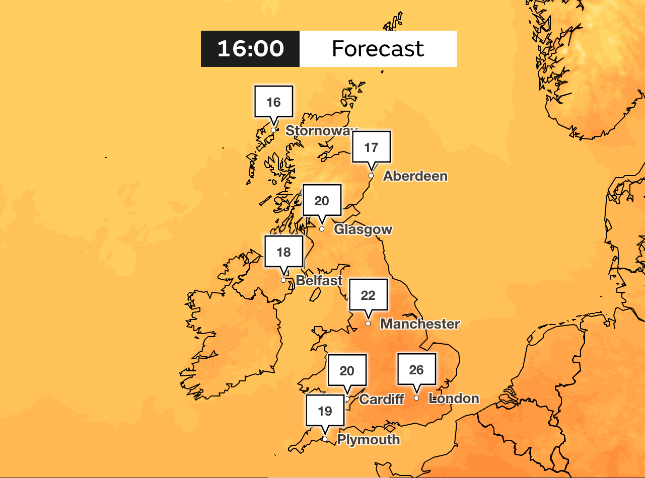
According to the Met Office, temperatures could climb to 26C on Wednesday in the South East and areas in the northwest of Scotland will remain bright.
The hot weather continues after the UK experienced a mini-heatwave last week with temperatures hitting 31.9C on Friday in central London.
On Tuesday, temperatures could drop to single figures in the early part of the morning – but only across parts of northern Scotland.
Wednesday is predicted to be the hottest day of the week, with temperatures reaching 26C but then dropping as schools break up for the summer holidays on Thursday.
The Met Office says showers will return in the west, with patchy cloud and intermittent spells of sunshine further south and east.
On Thursday, people can expect rain to arrive from the west and move gradually eastwards, with some downpours likely to be heavy.
Sporadic showers will follow on Friday and Saturday, with more changeable weather to follow, says the Met Office.
Met Office spokesperson Stephen Dixon said: “The long-range outlook for early August suggests what’s most likely is drier weather further south, with showers and rain more frequent further north and west.
“There remains a signal for some more changeable interludes of weather through the first half of August, with some periods of low pressure bringing periods of more unsettled weather at times.”
Monday to Wednesday
A fairly cloudy beginning to the week with predicted outbreaks of rain moving eastwards. Things will turn brighter with the rain becoming more showery and heavier showers are likely to be felt in northern areas of the UK yet temperatures will stay warm.
Odd showers can be expected on Tuesday, particularly in the early morning.
Wednesday to Friday
Temperatures will peak over 25C on Wednesday in parts of the southeast but these will drop to cooler conditions, maintaining mild conditions under 20C. Rain will move to the west later on, with a breeze expected on Thursday. Friday will see some showers in the north of the UK but the south will be drier.
Friday to Sunday
The first of the thunder will be felt towards the latter part of the week when a band of cloud and rain will clear south-eastwards. This will pave the way for scattered showers across much of the northwest but these will settle overnight.
End of July to August
The UK should continue to enjoy the sunny spells but can expect spells of rain as August is set to be changeable, says the Met Office.
Wet weather will be interspersed with intervals of dry, and bright weather with most of the rain to be felt across northern and western areas. Minimal rain is expected in the southern and eastern parts of the UK and temperatures may climb above average.
High UV levels will persist throughout the week and charities such as Cancer Research UK has highlighted the risks of a lack of sun protection during the summer months.
Cancer Research UK chief executive Michelle Mitchell said: “The fact that the majority of these cases are preventable underlines the importance of people taking sun safety seriously.”