New Delhi: The launch of the NASA-ISRO Synthetic Aperture Radar (NISAR) mission — a space collaboration between the US and India — is being pushed back from March to the second half of the year, said senior Indian Space Research Organisation (ISRO) and National Aeronautics and Space Administration (NASA) officials.
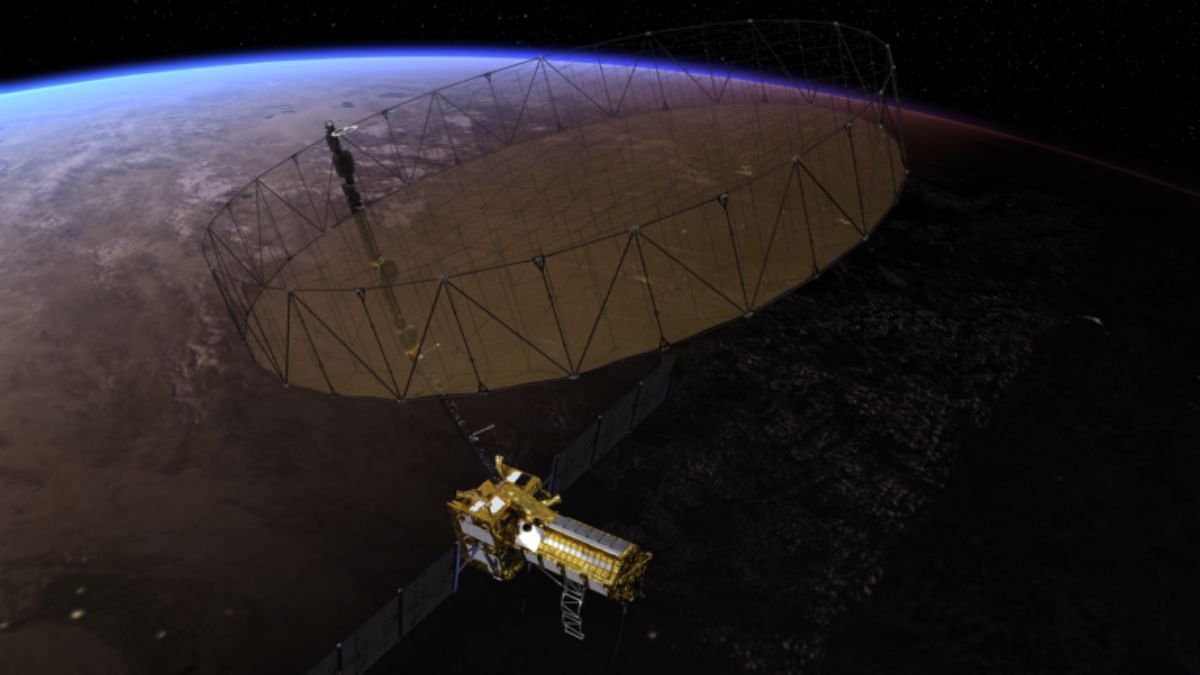
NISAR is a Low Earth Orbit (LEO) observatory that NASA and ISRO are jointly developing to map the land and ice surfaces of the Earth. It will provide insights into ecosystems, ice mass, vegetation biomass, sea level rise, groundwater, and natural hazards such as earthquakes, tsunamis, volcanoes, and landslides.
The mission, earlier set for a March launch, will get a new launch date by April-end, said US-based Jet Propulsion Laboratory (JPL), which is leading the mission for NASA.
ISRO chairperson S. Somanath also confirmed the delay in the mission with ThePrint. “We are now hoping to launch NISAR by the second half of this year, depending on what is jointly agreed,” he said.
According to the JPL, a final round of tests raised the need for a special thermal coating for hardware components of the satellite that is part of the mission. After completing the coating work, the two space agencies will set a launch date.
“Work to be finished before launch includes applying a special coating to hardware components on the satellite’s 39-foot-diameter (12-metre) radar antenna reflector, which is among NASA’s primary contributions to the mission,” Andrew Wang, JPL spokesperson for NISAR mission, said in an email response to ThePrint.
Also read: India’s first semi-cryogenic rocket launch deferred 3rd time in 2 weeks. Here’s why
‘Will image the entire Earth in 12 days’
The special coating will be added as a precautionary step to mitigate any temperature increases that could potentially affect the deployment of the reflector.
“Testing and analysis identified a potential for the reflector to experience higher-than-previously-anticipated temperatures in its stowed configuration in flight,” said JPL.
The mission will be launched from Sriharikota’s Satish Dhawan Space Centre, onboard Isro’s Geosynchronous Satellite Launch Vehicle Mark 2.
As part of the mission, a satellite carrying a Synthetic Aperture Radar (SAR) will orbit the Earth.
The SAR will use a unique information-processing technique, sweepSAR, to observe large swaths of the Earth’s surface and give high-resolution images.
The SAR mounted on an Integrated Radar Instrument Structure (IRIS), and the spacecraft bus, i.e., the satellite’s main body, will together form the NISAR observatory.
The radar will penetrate clouds and darkness, enabling NISAR to collect data day and night in any weather, read the mission document.
Its imaging swath, i.e., the width of the strip of data collected along the length of the orbit track, is more than 150 miles (240 kilometres), which means it will image the entire Earth in 12 days.
“…it will offer measurements of Earth’s evolving surface — including changes in ice sheets and glaciers, wetlands and forests, and land around volcanoes and earthquake faults,” read the mission document.
(Edited by Madhurita Goswami)
Also read: India gets 1st homegrown CAR T-cell therapy centre at IIT-B. All about breakthrough cancer treatment

