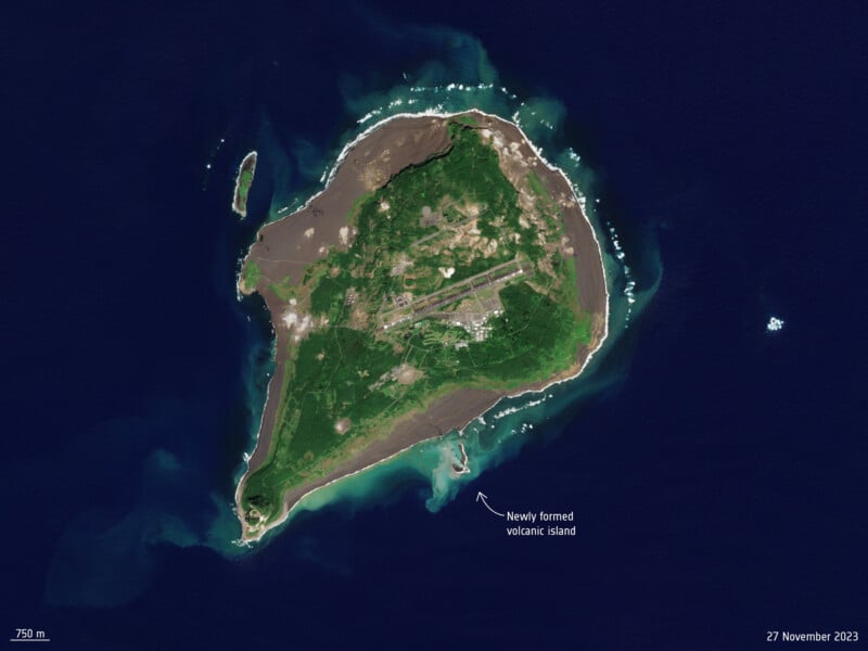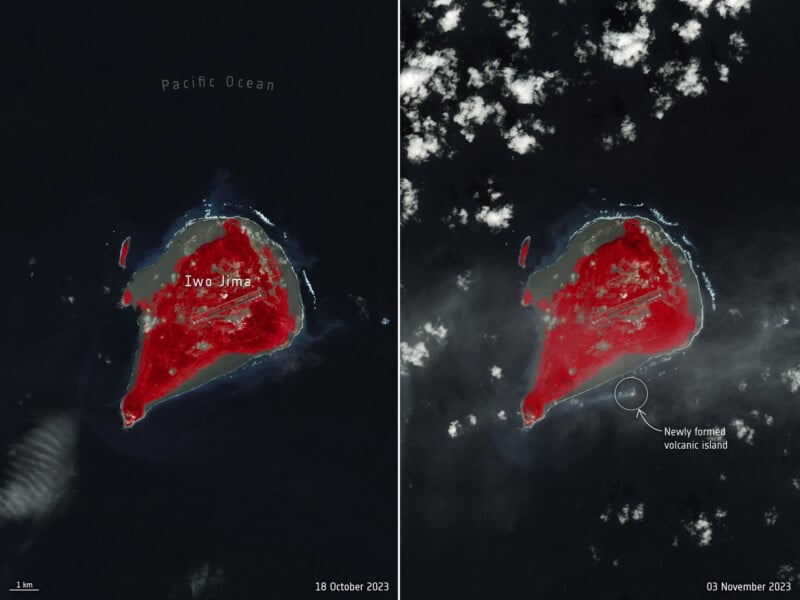
The “Earth’s newest island” can be seen growing from space in newly-released satellite photos.
On October 21, an underwater eruption hit off the southern shores of the island of Iwo Jima, Japan. The eruption birthed a new island named “Niijima” which translates to “new island.”

The new island, formed from the volcanic eruption, was photographed from space on November 3.
However, recent aerial images have revealed that the new Japanese island has doubled in size and that Niijima now looks very different from when it first emerged from under the ocean.
Newly released satellite imagery from the European Space Agency’s Copernicus Sentinel-2 satellite on November 27 revealed that Niijima has almost doubled in size and is continuing to grow.
While the island was reportedly just 754 feet long (230 meters) and 656 feet wide (200 meters) at the beginning of November, new satellite data shows it is now 1640 feet long (500 meters).
The ongoing growth of the island shows that the bubbling underwater volcanic activity that birthed the island off the southern coast of Iwo Jima is continuing.
A Volcanic Island on The Rise
The island of Niijima lies around 1200km south of Tokyo. It is the first major island to be created in Japan since 2013.
In a statement, The University of Tokyo said that the origins of Niijima can be traced to the volcanic eruption that began on October 21.
By October 30, scorching hot magma from this volcanic activity met the ocean and exploded, forging rock chunks several feet long and launching them over 160 feet (50 meters) into the air.
As the undersea volcano erupted, hot magma and rock were flung up onto the seafloor, building up into the new island, which burst forth from the waves surrounded by floating rocks of porous volcanic pumice.
Image credits: All photos by the European Space Agency.
